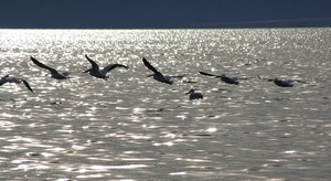
 The surface of the water dances with sparkling sunlight, a million points rapidly flashing, the
deeply carved slopes of the bare desert mountains stand muted in the hazy air and just offshore a
line of white pelicans fly in their characteristic undulating pattern.
The waters of the Salton Sea provide a smorgasbord for migrating birds travelling the Pacific Flyway and from our waterside campsite the amazing view and the avian activity are keeping us entertained.
The sea is approximately thirty five miles long and fifteen wide, the entire body well below sea
level. From where we’re parked it’s nearly ten miles to the opposite shore although that’s hard to
believe: landscapes on this scale make judgement of distance a very tricky business, the mountains
appear no more than a couple of miles away.
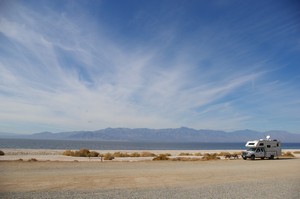 Looking along the length of the sea there is no visible shore just a watery horizon in the distance,
it’s southern limit hidden by the curvature of the earth.
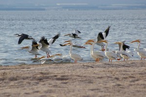
Squadrons of pelicans, both white and brown snooze along the shore in the afternoon sun, a couple
of sentries keeping watch. One wakes, stretches its neck, its beak translucent, backlit by the sun.
Another flexes its wings before settling back down for another forty winks. Our gradual approach
along the beach comes to the attention of the lookouts who alert the group to our presence. They
become unsettled and relocate into the water, amidst an impressive display of wingspans.
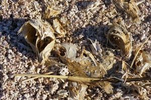
However beautiful it looks today, appearances can be deceptive. The present shoreline is crunchy
underfoot a combination of tiny barnacle shells, salt crust and rapidly-dried sandy mud. Dense
areas of dead fish remains line parts of the shore indicating that all is not well while
reports of massive bird kill-offs and
horrendous smells emanating from the depths are a sure sign that the ecosystem is out of balance.
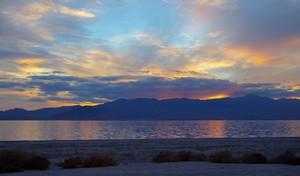
The second lowest point in the US lies beneath the water, the nadir of the Salton Sink Basin. Originally the basin was part of the Gulf of California but over time became landlocked. In wet periods it was flooded by the Colorado River, leaving a lake that would gradually shrink during drier times, the wet dry cycle alternating with the natural pattern of weather. In more modern times the basin was dry, that is until the accident of 1905, when during a particularly wet period, the Colorado River broke through a badly constructed canal cut and for nearly a year and a half the entire volume of water poured into the sink, producing the current incarnation of the Salton Sea, before engineers finally managed to divert the flow back to its original course.
 The inland sea has no natural outlets and few feeders, most of the latter being of suspect quality
in the form of agricultural run off. Its level has dropped by thirty feet in a little over a
hundred years, the salinity rising proportionally and it is now forty percent more concentrated
than the oceans. Its survival as a feeding and resting place for migratory birds is in doubt, with
many fish unable to tolerate the saline concentration.
After numerous delays, many the result of the politics of water, the State of California finally has restoration plans that are moving ahead, aimed at creating specific areas suitable for the seasonal visitors. The future of the sea as a whole is in the balance, proposals and plans still being discussed but according to the The Audubon Society time is running out.