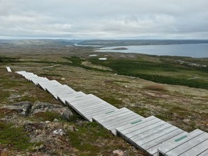
 We arrive in Labrador on an overcast morning and while approaching West St Modeste, see an
unnaturally straight line crossing the bare hilly landscape. It’s the Bouquet’s Hill Trail,
a series of boardwalks and steps that climb the gentle hills behind the town. Crossing the
wet boggy lower areas where the mosses are thick and the small trees densely packed, we follow
the trail onto the uplands where the trees vanish and a dense low-to-the-ground vegetation takes
over. There are thick carpets of caribou lichen, so called because it provides food for the
herds in the winter months. They can smell it through the snow and scrape away the covering
layers revealing one of the only sources of sustenance available during the cold season.
 The lichen is surprisingly dry and soft to the touch and springy underfoot and before our time in
Labrador is done, we’ll come to realise just how pervasive it is. Vying for space on the hills are
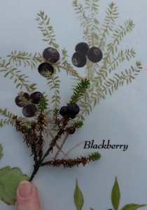
dense patches of berry bushes; blueberries, partridgeberries and what are known locally as
blackberries, the latter proving to be crisp, juicy but largely tasteless. Muted autumn colours
dominate the gentle curves of the landscape stretching off into the distance while the cold steely
grey waters of the Strait of Belle Isle glint occasionally in a moment of sunlight, the small
settlement scattered on the lower coastal stretch.
Further along the coast, Red Bay is another typical small settlement strewn out along the curve of
its protected bay. In the sixteenth century it was home to Basque mariners who set up a number of
whaling stations in the area. Unfortunately the Red Bay National Historic Site is closed for the
season but out on the Boney Coast trail we see plenty of evidence of the previous industry, with
whale bones littering the rocky beach and grassy shore. It must have been home to some gruesome
sights and smells as the whales were butchered and the oil rendered.

Back in the present, we’re here to drive across a huge swathe of Labrador and down through Quebec
to the St Lawrence River. We’ll be travelling the Trans-Labrador Highway and then Highway 389
through the French speaking province. It’s one of a few stretches of Canadian road that is still
not completely paved. It crosses a vast area with little settlement, largely undeveloped except
for small knots of population gathered for the express purpose of hydro-electric generation or
mining. It skirts one of the true wilderness areas left on the continent and gives a glimpse into
that world.
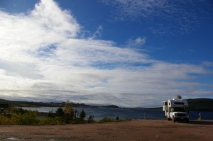
We plan to spend the night at Red Bay where the initial section of paving gives way to the gravel more usually associated with this iconic road. We’ve been told that the first forty kilometres north of Red Bay are bad and as we bounce from one pothole to the next, so many that we’re unable to cut a line between them, we begin to realise that the warnings were understated. With five hundred and thirty eight kilometres of unpaved road stretching out ahead of us we share a few misgivings.
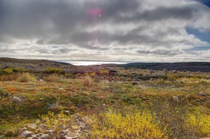 Teeth rattling, we still manage to enjoy the landscape: more of the muted autumn colours, no trees,
the ground strewn with rocks, numerous ponds, plenty of lichen and moss and views to the ever distant
sea. Little by little we come into the taiga with its well spaced trees and carpet of caribou lichen
and the road gradually improves. Now I don’t want to give the wrong impression, there’s improved and
then there’s improved; these things are all relative and in this case it simply means that some bits
are slightly better than others.
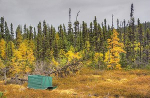
This section of the road passes through a number of small settlements and the taiga is clearly
subject to harvesting. At regular intervals there are brightly coloured sleds of a very particular
ilk used to bring lumber to the roadside. We have read that their design has hardly been changed
since the first European settlers came here and copied the sleds used by the Innu in this area.
By the time we stop for diesel in Port Hope Simpson, a hundred and thirty five kilometres down the road, my usually good manners have been shaken out of me. The woman in the shop asks, “How are you finding our road?” I reply, “Terrible!”. She looks momentarily surprised and then grins, saying “That’s honest” and goes on to explain that it’s deteriorated more than usual this summer.
As we pull out of Port Hope Simpson we’re leaving behind the string of tiny settlements along this section of the road; there’s no human habitation along the next four hundred kilometres of Highway 510, not a single house, no electric or phone lines. It’s unlike any other part of North America that we’ve been to so far.
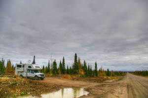 Somewhere down the road we pull into a short track to an old sand quarry for the night. These
quarries, either sand and gravel or rock are not uncommon; it's where the raw materials to build
the road have come from and the next day we see huge rock crushing machines at work in preparation
for further maintenance or upgrading of the road.
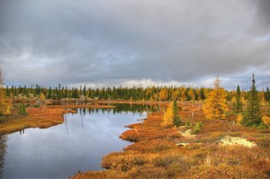
As we drive towards Happy Valley-Goose Bay, conveniently abbreviated to HVGB, the taiga continues
to stretch out in all directions; wetlands, shrublands, meadows, and open forests. The tamaracks
stand in their golden autumn colours, warm against the deep greens of the spruce and pine. The
meadows are yellow and the water dark in the muted overcast conditions.
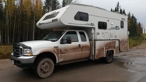
While parts of this section of the road are every bit as bad as the early stretch, there is evidence that it has been surveyed and in some areas, active construction is widening the road. Huge construction vehicles trundle up and down. Health and safety is a different consideration up here; there’s no stopped traffic while they pass, we’re just trusted to stay on our side of the road and believe me, there’s plenty of incentive to do so. The surface is still dirt and gravel but maybe it’s being prepared for paving next year. In the meanwhile they're making the gravel from a delightful rock with a high iron content and in the rain that has started, it produces a thick red slush that coats the truck and camper. Someone’s going to have fun cleaning it!
 HVGB is a town of six thousand with a NATO base and a large Innu population. It’s a bit soulless and
like many of the small settlements, does not have a centre. It does however have a supermarket and
more importantly a restaurant with the best tasting pizza we’ve had in a long time. We park tucked
behind the community college and make an early start at Tim Hortons for breakfast. This is Canada’s
equivalent of Dunkin or Krispy but is more like a national institution. They are busy any time of
the day or night and at this particular branch they’re queuing out onto the road to join the line
for the drive-through.
In the petrol station at HVGB, a woman tells Sterling that the day before they had followed us on The Road. People along this amazing road are clearly proud of it and are keen to know how far we’re going. Sterling delights in the phrase, “All the way!” It’s clear from other conversations that one does not drive the road, one goes over it and it somehow seems like a fair description, possibly because we’ve almost been airborne a few times, bouncing between the potholes.
As we travel this road we have come to realise that it is a work in progress: more is getting paved each year. The sixty kilometres of paving that we are expecting on the next stretch has been extended this season and much to our delight gives us a bonus sixty five kilometres of tarmac before we slow down once again for the gravel.
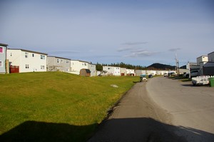 Our next stop is Churchill Falls; the strangest community we have ever visited. It’s a company town
and everything, except the post office and the petrol station that doubles as the off license,
is owned by Nalcor Energy who operate
the hydro plant. The population is about six hundred and fifty, predominantly families, many of
whom are here for the long haul. There are no older people here; when someone retires, they have
a few months to make arrangements to move out of their company owned housing. Given there’s no
other housing in town, there’s not much choice but to leave. Sterling, in a more fanciful moment,
likened it to a dystopian science fiction book where the elderly mysteriously vanish and the
absence of anyone over fifty five is only mentioned by outsiders.
There are only a handful of house styles and this gives the town the appearance of a model that has been built at full scale. It is also laid out in an interesting pattern, dictated by the weather. The average annual snowfall of five metres is something of a challenge and in an effort to create space for the snow cleared off the streets, the houses are only built on one side of the roads, wide grassy banks await their wintery blankets on the other.
When people first arrive, they are allocated an apartment for their six month probation period. If they stay, they go on the waiting list for a single family house. Contractors who come for limited periods and do not bring family are housed in special accommodation with all their meals catered in the Staff House.
Churchill Falls has many of the facilities you’d expect in any small town: a post office, a medical centre, a school which we’re told lacks for nothing and has enviable pupil to teacher ratios, a library, a pool and sauna and a small supermarket where the prices are clearly subsidised and do not reflect the additional costs of transport to this isolated location.
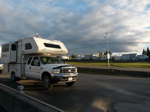 The Town Office appears to be the centre of administration for the settlement and this is where we
stop to enquire about the free tour of the hydro plant. There is only one a day but we’re invited
to stay the night on the electric hookups outside the Town Centre; a large building housing the
school, supermarket, pool etc. The next afternoon we’re picked up and taken out to the plant and
not surprisingly, we’re the only people on the tour.
We’re kitted out in the usual safety garb; hard hat, high visibility vest, protective glasses that
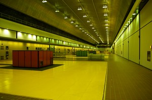
look remarkably fetching over my own spectacles and of course ear plugs. The powerhouse is three
hundred and ten metres below ground. We emerge from the lift into the bowels of the earth; tunnels
and halls hewn out of the granite without the benefit of blasting. We’ve been in other underground
generating stations both in the states and in Wales but this is by way the largest with a powerhouse
that stretches nearly three hundred metres in length and a generating capacity of 5,428,500 kW.
The water system that this giant relies on flows from a series of connecting reservoirs; so large in area that it takes a couple of days to increase the flow and ramp up the power. This is in stark contrast to Electric Mountain in Wales, where the surge in demand, as everyone puts on the kettle for a brew during halftime or at the end of the most popular soaps, has to be anticipated and responded to.
The hydro plant and town are named for Churchill Falls that today is a shadow of its former self.
Before 1970, it was the third most powerful waterfall on the North American continent but today the
intake channel for the generating plant diverts water from the Churchill River leaving barely a
trickle in the original course. We have read that water only makes it as far as the Falls during
spring thaw or times of exceptional rains so we are fortunate to see what little we do cascading
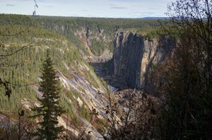
over the lip and down the sheer walls of MacLean Canyon. With or without the Falls, the canyon is
quite impressive and from the viewpoints along the short trail it is well worth the stop.
From Churchill Falls it’s only another two hundred and fifty kilometres, all of it paved, to Labrador City. This section has a very different feel to early parts of the road; electric lines run along the roadside while huge pylons march over the landscape carrying power from the generating plant down to Quebec and occasional houses are tucked among the trees.
Lab City, as the locals call it, is home to a huge mine and is consequently a very industrial and not very inspiring town. We don’t linger and drive the final fifteen kilometres to the border with Quebec where the Trans-Labrador Highway technically ends. This is largely a matter of semantics as the only options at this point are to turn around and drive back to Red Bay, now nearly eleven hundred kilometres away or to press on through Quebec on Highway 389, for the next five hundred and seventy kilometres, much of which is unpaved.
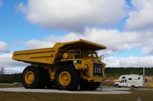 We choose the shorter option and before too long make a quick diversion to Fermont, another company
town. Not speaking French, it takes us a while to realise that fer mont literally means
iron mountain.
Once we’ve grasped this we feel we have to make a quick stop. After all, Sterling was born in Iron
Mountain, MI. Fermont was built for the iron mine that dominates the town. It’s on a much larger
scale than Churchill Falls and has none of the unusual character. On the edge of town we stop to
admire a huge dump truck, number 172, retired in a town park. According to the sign board, it has
a capacity of one hundred and ninety tonnes and looks very similar to the ones we were sharing the
road with back in Labrador. During it’s working life between 1988 and 2005, it moved thirty four
million tonnes of material around the mine.
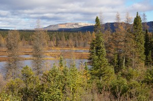 The mine itself comes into view as we leave. This is no small undertaking; an entire mountain is on
the move. Mont Wright is systematically being levelled, the ore extracted and the tailings being
deposited in what looks like a new mountain; in effect they’re moving the mountain a mile down the
road!
This stretch of Highway 389 is unpaved and in places inexplicably twisty. It’s a little hard to fathom given there’s so little out here and the road is crossing an open plain for much of this section. We share the landscape with the railway line that carrys ore from the mine, crossing the rails nine times in the next forty kilometres or so.
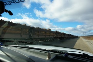 Given the long distances between petrol stations, the wise money is on filling the tank at every
opportunity and at Relais Gabriel we pay dearly for this strategy. At $1.87CAN per litre it’s the
most expensive diesel we’ve ever bought in North America and equates to $6.87US per gallon. Of course,
in Britain where diesel is the equivalent of $8.66US per US gallon this would be a snitch. But it’s
also worth mentioning that when we were paying those prices, our Citroen C4 averaged less than a
quarter of the fuel consumption of this thirsty truck.
After a night in another deserted quarry, we’re heading towards Lac Manicouagan, a massive ring
shaped lake that sits in what is left of an impact crater produced by an enormous meteor eons ago.
Its distinctive shape is not visible from ground level but is clearly evident from space and I have
wanted to visit, since learning about it some months ago.

It’s a bright sunny day and we’re the only people on the shore although the track marks in the sand suggest that wolves have been through fairly recently. The lake is a beautiful deep blue, the sky a shade lighter. Out across the water, the rounded tree topped islands are visible, on shore the warm coloured rocks create a natural contrast to the blue. It’s incredibly quiet and peaceful, the loudest sound, gently lapping water. We’re reluctant to leave when it’s time to move on.
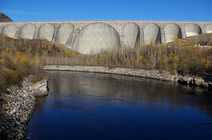 The lake is now part of a huge hydro system comprising five stations strung out on the Manicouagan
River that it winds its way down to the St Lawrence. The first one we come to, known as Manic Cinque,
is the largest of them and we catch a last view of the lake albeit in a somewhat less natural setting.
From this point, the road is paved but in places manages to be some of worst paving we’ve experienced, making us
yearn for the gravel. The vegetation is gradually changing and as the taiga ends, technically at the
fifty second parallel, the trees become more densely packed, deciduous vegetation returns and the
caribou lichen disappears.
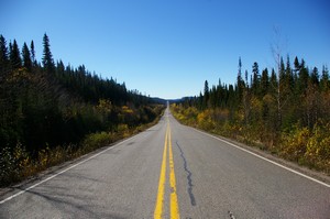 The concentration of autumnal leaves along the roadside gives the impression of our way being
highlighted in the bright sunshine. There’s also a feeling of coming out of the real isolation;
more cars, trucks and occasionally houses.
Five days and four nights after leaving Red Bay and 1770 kilometres, or 1100 miles from the start of the Trans-Labrador Highway, we arrive in Baie Comeau, the official end of this remarkable road.